Activity Overview
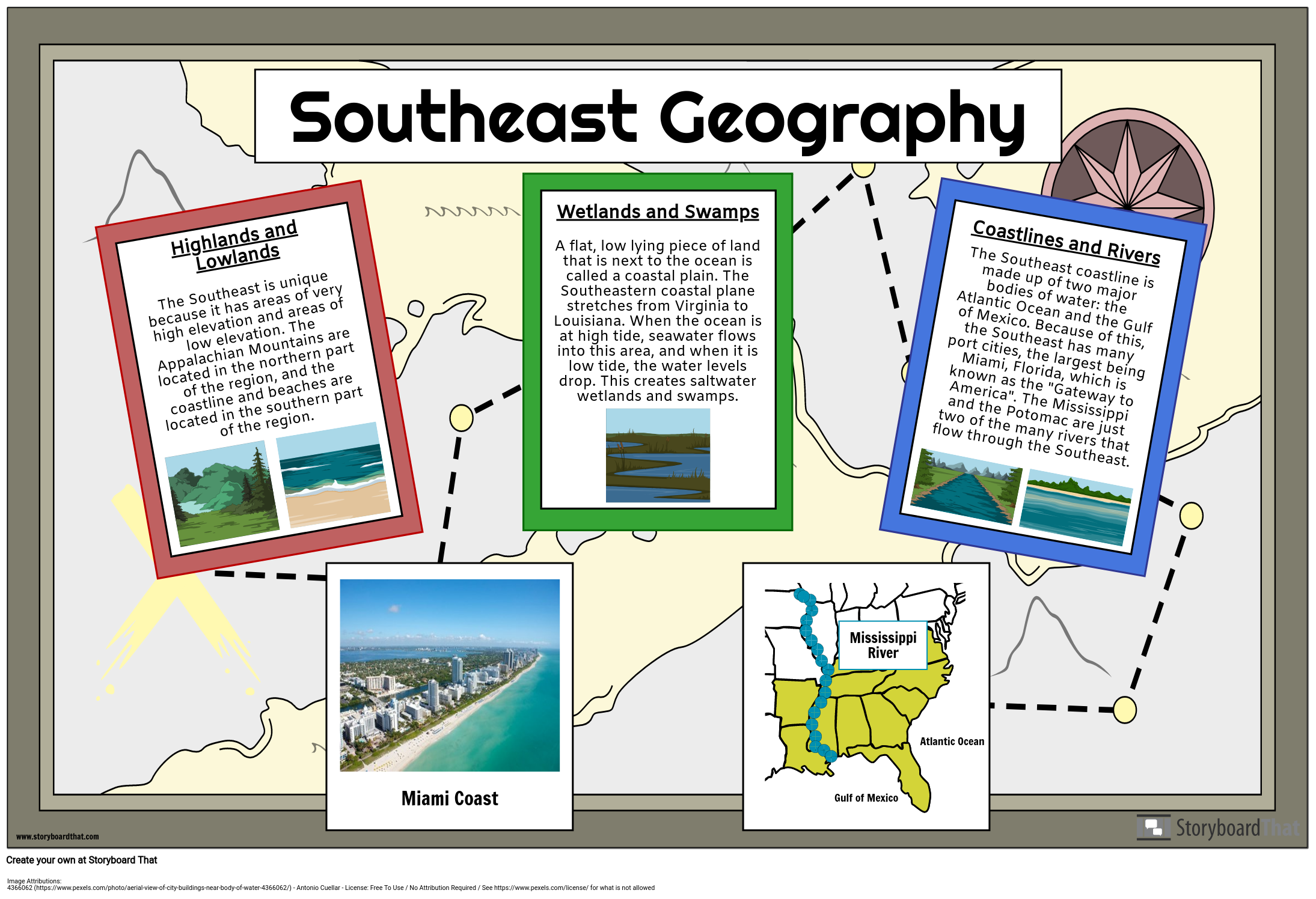
The Southeast has very unique geographical features. It has both mountains and coastlines, hills and valleys, rivers and swamps. In this activity, students will research the geography of the Southeast and create an informative poster that includes geographical features, facts, and colorful illustrations. Students should be encouraged to focus on the entire region, although this activity could be extended to focus on a singular state so students can educate each other on their findings.
You can find more travel poster templates to add to this assignment to give students a variety of choices for their poster!
Template and Class Instructions
(These instructions are completely customizable. After clicking "Copy Activity", update the instructions on the Edit Tab of the assignment.)
Due Date:
Objective: Create a poster highlighting the geographical features of the Southeast.
Student Instructions:
- Click “Start assignment”.
- Using school resources, conduct research about the geography of the Southeast.
- Create a poster about Southeast geography, including facts and illustrations.
Lesson Plan Reference
Rubric
(You can also create your own on Quick Rubric.)
| Proficient 33 Points | Emerging 22 Points | Needs Improvement 11 Points | |
|---|---|---|---|
| Text | The text on the poster includes important facts, is accurate and is pertinent to the topic demonstrating a solid understanding of the subject. | The text on the poster includes some important facts, is mostly accurate and is pertinent to the topic demonstrating an emerging understanding of the subject. | The text on the poster does not include enough important facts. The information is not accurate or is not pertinent to the topic. |
| Artistic Depictions | The art chosen enhances the poster by symbolizing or illustrating important facts. Time and care is taken to ensure that the design is neat, eye-catching, and creative. | The art chosen is mostly accurate, but there may be some liberties taken that distract from the assignment. The design constructions are neat, and meet basic expectations. | The art chosen is too limited. The design appears rushed and incomplete. |
| English Conventions | Ideas are organized. There are few or no grammatical, mechanical, or spelling errors. | Ideas are mostly organized. There are some grammatical, mechanical, or spelling errors. | Storyboard text is difficult to understand. |
How To Explain the Geographical Significance of US Southeast Region
Introduce Geography
Introduce the subject and concept of geography to students and ask them what they already know about it. Build on their knowledge and plan the lectures according to their already existing knowledge. Teachers can focus on only a few aspects of Geography at this point depending on the abilities and understanding level of students.
Explain With Maps
Maps are a significant part of geography and they are an interesting visual element for the subject. Teachers can use interesting maps to explain the geography of the region. They can also conduct different interactive activities with the help of maps.
Talk About Diversity
Draw attention to the Southeast Region's diverse geographic locations. Talk about the fact that it encompasses arid plains, hilly places like the Appalachian Mountains, and coastal regions along the Atlantic and Gulf of Mexico. Ask the students why diverse terrains are significant and important for a region and how they can help the region as well as the country.
Discuss Geography and History
Emphasize the region's historical significance to American history. Describe how it affected the Civil War and how the Civil Rights Movement was affected by it. Teachers can connect both subjects of Geography and History to encourage critical thinking and reinforce other concepts related to both subjects.
Ensure Flexibility
Teachers can work according to the pace of students and customize their lessons based on the learning of students. Providing flexibility can help students explore their creativity and imagination and foster a safe and healthy environment for students to gain knowledge.
Frequently Asked Questions About Making a Geography for US Southeast Region
What aspects of the US Southeast Region can the students cover in their geography poster?
Students can cover themes like states and capitals, significant cities, geographical characteristics (such as rivers and mountains), climate, industry, culture, and historical significance in a geography lesson for the U.S. Southeast Region. They can also include visual and symbolic elements that can enhance the overall poster and make it look interesting.
What additional activities can the students engage in to discuss and learn more about the topic?
For students who want to explore deeper into particular facets of the geography of the Southeast Region, offer extra readings, recommend documentaries or instructive films, or provide advanced study subjects. Students can watch informative videos and gain knowledge from different resources present on the internet with the help of their parents or guardians.
More Storyboard That Activities
US Regions: Southeast
- 4366062 • Antonio Cuellar • License Free To Use / No Attribution Required / See https://www.pexels.com/license/ for what is not allowed
Pricing for Schools & Districts
© 2024 - Clever Prototypes, LLC - All rights reserved.
StoryboardThat is a trademark of Clever Prototypes, LLC, and Registered in U.S. Patent and Trademark Office


