Activity Overview
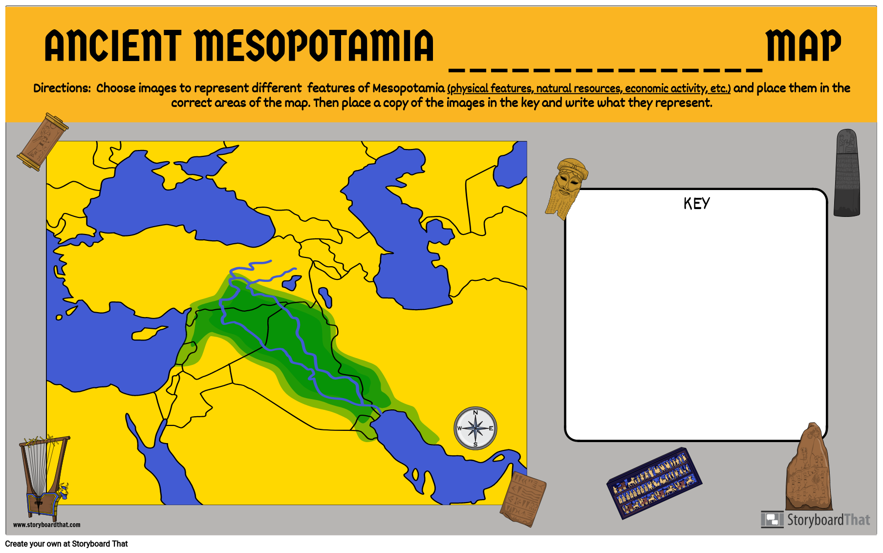
After students learn about the geography, natural resources and/or economy of Mesopotamia, it can be helpful for them to see everything together on one map. In this activity, students will create a map that displays physical features, where natural resources are found, and what economies are found in different parts of the region. Students will also make a key to reference and add descriptions to explain the images they've chosen.
Template and Class Instructions
(These instructions are completely customizable. After clicking "Copy Activity", update the instructions on the Edit Tab of the assignment.)
Due Date:
Objective: Create an economic / natural resources or physical features map of Mesopotamia.
Student Instructions:
- Add different images that represent the physical features, natural resources or jobs from the region.
- Add the images to the key on the side with words describing what they are.
Requirements: 5-7 images that represent either physical features, natural resources or economic activity placed in accurate locations on the map. Place the images with definitions in the key.
Lesson Plan Reference
- CCSS: RH.9-10.3 - Analyze in detail a series of events described in a text; determine whether earlier events caused later ones or simply preceded them.
- ELA-LITERACY.CCRA.R.1 - Read closely to determine what the text says explicitly and to make logical inferences from it; cite specific textual evidence when writing or speaking to support conclusions drawn from the text.
- ELA-LITERACY.CCRA.R.7 - Integrate and evaluate content presented in diverse media and formats, including visually and quantitatively, as well as in words.
- ELA-LITERACY.CCRA.R.9 - Analyze how two or more texts address similar themes or topics in order to build knowledge or to compare the approaches the authors take.
- ELA-LITERACY.WHST.6-8.2.B - Develop the topic with relevant, well-chosen facts, definitions, concrete details, quotations, or other information and examples.
How To Help Students Analyze the Map of Ancient Mesopotamia
Give an Overview of Maps
Show the students how to find their way around a map by teaching them self-orientation. Teachers can first teach the basic features of a map to students and then move towards more specific features related to Ancient Mesopotamia. Name the main geographical characteristics, and cardinal directions and describe the role that the rivers Tigris and Euphrates had in the development of the area.
Discuss Important Geographical Features
Rivers, mountains, and other prominent natural features should be highlighted and discussed when looking at the map. In Ancient Mesopotamia, highlight how these characteristics impacted commerce, agriculture, and settlement patterns. Here students can engage in analysis to connect various aspects of a civilization with its geography such as the politics and the economy.
Use Colors and Symbols
In order to make the map more interesting and easy to remember, teachers can use colors and symbols to highlight the differences between different parts of the map. For instance, different colors can be used to represent different territories within the civilization and different symbols can be used to represent any landmarks, waterbodies, or famous places in Ancient Mesopotamia.
Engage in Activities
Once students are more familiar with the map of Ancient Mesopotamia, teachers can engage students in interesting and analysis-related activities. For instance, asking students to compare ancient and modern maps to identify where the civilization would be located in the modern world, or playing puzzles using the map.
Encourage Critical Thinking
Encourage the students to reflect on all the insights gained from the activities and provide their feedback and perspective on the activities. Ask the students to think about how different things connect with each other and how history shapes modern society to encourage critical thinking and analysis.
Frequently Asked Questions About Creating a Map of Ancient Mesopotamia
Which geographic characteristics should be prominently displayed on the map?
The Tigris and Euphrates rivers, large towns (such as Ur, Uruk, and Babylon), mountain ranges, and any other noteworthy monuments are considered key characteristics. Stress the importance of accurately depicting these characteristics on the map and how these characteristics can be used to depict other features of the civilization.
What more details can the students add to the map to make it more comprehensive and interesting?
Annotations or captions that give historical context—such as the importance of certain towns, significant events, or trade routes—can be added by students. This gives the map more depth and reveals a sophisticated knowledge of the area.
More Storyboard That Activities
Ancient Mesopotamia


Introductory School Offer
ONLY$500
- 1 School
- 5 Teachers for One Year
- 1 Hour of Virtual PD
30 Day Money Back Guarantee • New Customers Only • Full Price After Introductory Offer • Access is for 1 Calendar Year
© 2025 - Clever Prototypes, LLC - All rights reserved.
StoryboardThat is a trademark of Clever Prototypes, LLC, and Registered in U.S. Patent and Trademark Office


