Map of Canada

You can find this storyboard in the following articles and resources:

Geography of Canada
By Lauren Ayube
Canada is located in North America, just north of the United States, and is the second largest country in the world. Canada is known for its beautiful landscape, lakes, and wildlife. The following activities will teach students about Canada’s geography, provinces and territories, natural resources, national symbols, and treasured wildlife.
'
Storyboard Description
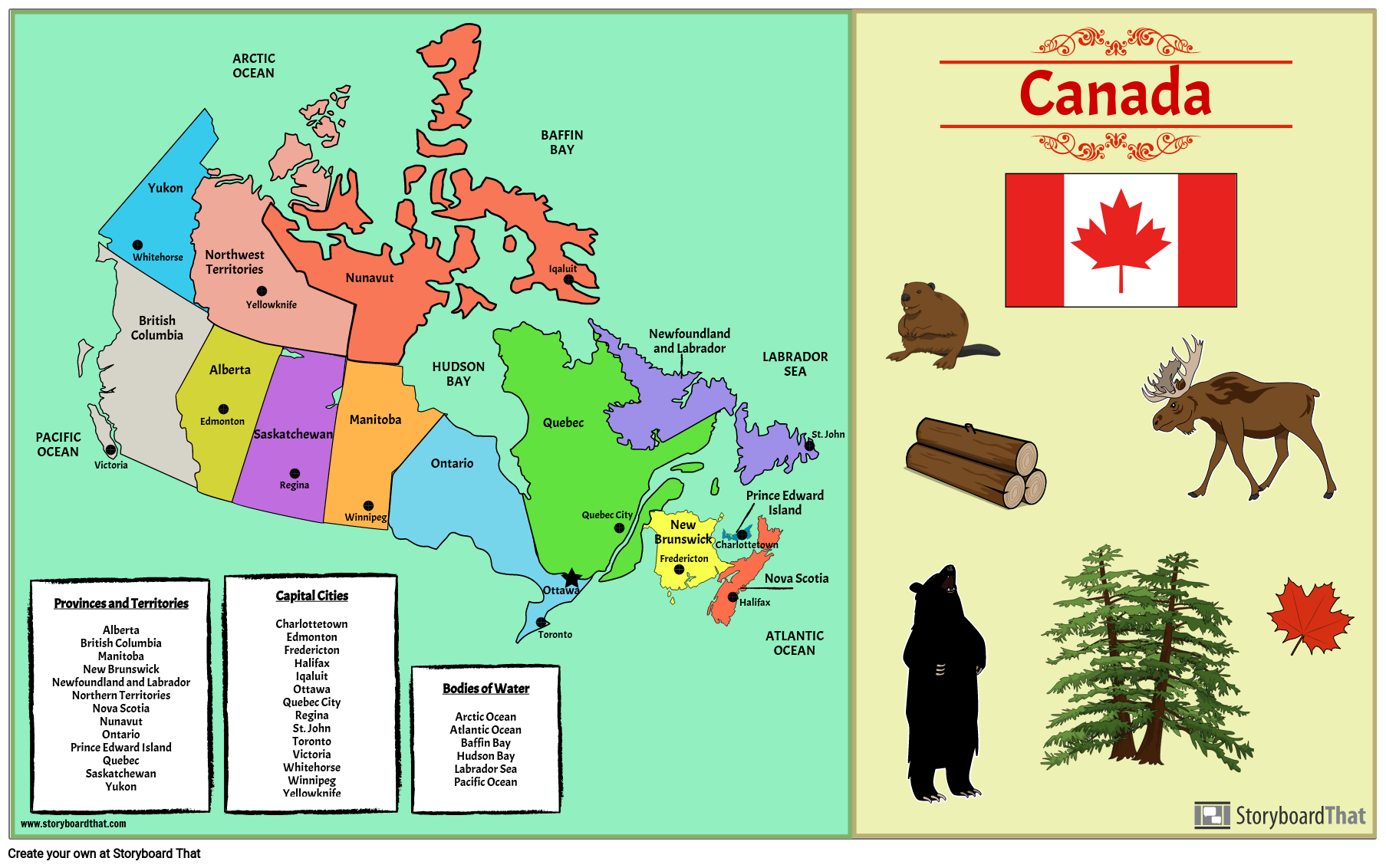
Label a map of Canada! Include provinces, territories, capitals, and bodies of water.
Storyboard Text
- PACIFIC OCEAN
- Provinces and TerritoriesAlbertaBritish ColumbiaManitobaNew BrunswickNewfoundland and LabradorNorthern TerritoriesNova ScotiaNunavutOntarioPrince Edward IslandQuebecSaskatchewanYukon
- Victoria
- British Columbia
- Whitehorse
- Yukon
- Edmonton
- Alberta
- Northwest Territories
- ARCTIC OCEAN
- Capital CitiesCharlottetownEdmontonFrederictonHalifaxIqaluitOttawaQuebec CityReginaSt. JohnTorontoVictoriaWhitehorseWinnipegYellowknife
- Yellowknife
- Saskatchewan
- Regina
- Winnipeg
- Manitoba
- Nunavut
- Ontario
- Bodies of WaterArctic OceanAtlantic OceanBaffin BayHudson BayLabrador SeaPacific Ocean
- HUDSON BAY
- Quebec
- Toronto
- Ottawa
- BAFFIN BAY
- Iqaluit
- Quebec City
- Newfoundland and Labrador
- New Brunswick
- Fredericton
- Charlottetown
- Halifax
- Prince Edward Island
- Nova Scotia
- ATLANTIC OCEAN
- LABRADOR SEA
- St. John
- Canada
Over 30 Million Storyboards Created


