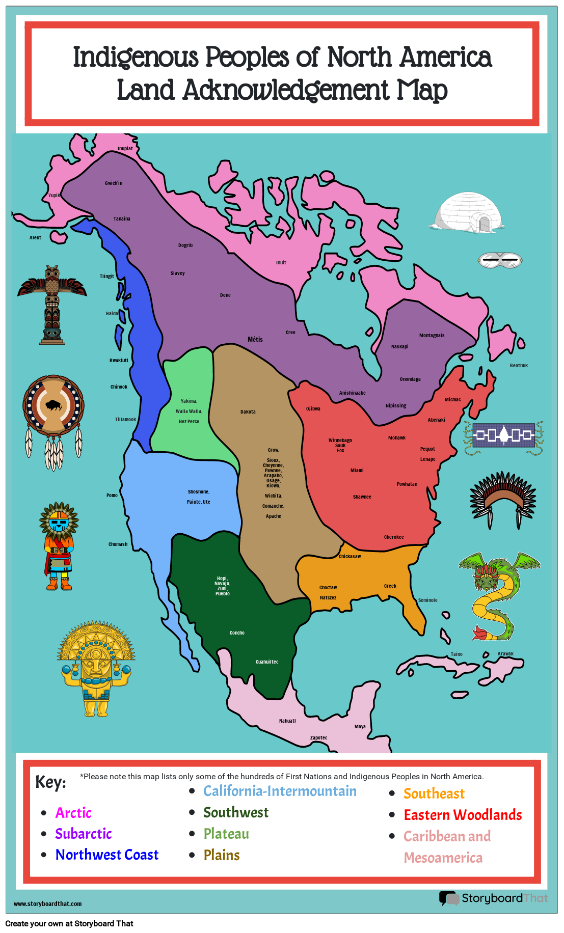
Indigenous Peoples of North America, Land Acknowledgement Map

You can find this storyboard in the following articles and resources:

The Age of Exploration in America
Lesson Plans by Matt Campbell
Before the 1400s, the 'Known World' was limited to Europe, parts of Africa, and parts of Asia. Learn more about the Age of Exploration with Storyboard That!
'
Storyboard Description
Students can label the locations of Indigenous groups who called North America home before the European explorers.
Storyboard Text
- Aleut
- Indigenous Peoples of North AmericaLand Acknowledgement Map
- Yupik
- Tlingit
- Gwich'in
- Haida
- Pomo
- Kwakiutl
- Chinook
- Tanaina
- Tillamook
- Inupiat
- Slavey
- Yakima,Walla Walla,Nez Perce
- Dogrib
- Shoshone, Paiute, Ute
- Dene
- Dakota
- Métis
- Crow,Sioux,Cheyenne,Pawnee,Arapaho,Osage,Kiowa,Wichita,Comanche,Apache
- Inuit
- Cree
- Ojibwa
- WinnebagoSaukFox
- Anishinaabe
- Miami
- Shawnee
- Nipissing
- Mohawk
- Naskapi
- Powhatan
- Onondaga
- PequotLenape
- Montagnais
- Abenaki
- Micmac
- Beothuk
- .
- Key:ArcticSubarcticNorthwest Coast
- *Please note this map lists only some of the hundreds of First Nations and Indigenous Peoples in North America.
- Chumash
- California-IntermountainSouthwestPlateauPlains
- Hopi, Navajo, Zuni, Pueblo
- Concho
- Cuahuiltec
- Nahuatl
- Zapotec
- ChoctawNatczez
- Chickasaw
- Maya
- Creek
- Cherokee
- SoutheastEastern WoodlandsCaribbean and Mesoamerica
- Seminole
- Taino
- Arawak
Over 30 Million Storyboards Created


